
|
The last time I heard thunder was September 2025. Now a new year and a new Spring has arrived and the storm season is finally with us once again and I wondered when will I ever hear thunder again? April 15th had been showing on the models for a week in advance however at such time scales I rarely place faith in the event as you can be certain as the days count down the target day will be either downgrade or vanish completely, this is the nature of convective weather forecasting. Five days until target day and it was still showing, confidence was growing, all indications were this would be the best CAPE day of the season so far and I was starting to get excited. Then four days to go it vanished, there was absolutely nothing showing for that date, this was typical and such a let down, I scolded myself for ever getting excited in the first place, I should have known better, however early season nerves can play havoc to chasers, the desire is often strong to see something cool to get the season under way in a positive note, from a mental perspective it really does make things easier if you witness something special early, then we feel less tense and more open to bigger things to come, it's only then that we experience a sense of flow and the season falls into place perfectly.
Then April 15th appeared back on the models, just from nowhere as if nature decided it was time to give you guys a break and present you with something exciting to keep the faith. The day got support from all other models and very quickly it became a verified set-up, this would be the first proper chase day of the year. Outlooks were issued by various sources, even ESTOFEX stepped up issuing their first forecast for Ireland of the year with their moderate risk lightning box covering all of the country, yet amazingly the Met Office never issued a single yellow warning for rain or lightning which confused many of us. The set-up was as follows, overnight frontal rain would clear then during the morning a cold front would moving SW to NE across all of the island, as this cold front moved N it would weaken and fragment, in fact, morning observations and satellite imagery showed this exact prediction unfolding, this was good news, the dying front allowed good breaks in the cloud to develop over SW Ireland which could be seen moving NE allowing solar heating to aid with lift.
Behind the cold front a moist warm air mass was advected across the surface on a Sly flow. A widespread -30c cool pool aloft in conjunction with a trough moving NE later in the day would aid with priming the atmosphere for storms. Models indicated 600j/kg of CAPE, with pockets of 800 to even 1000 j/kg with moderate to strong 20 to 30 knots of 0-6km shear which would allow for multicell storm clusters. Some models were showing a 60% chance of lightning and given the low LCL and shear funnel clouds and weak tornadoes were possible anywhere. I studied all models intensely to help me choose a target area, it seemed any part of N. Ireland could see a storm however the midlands and W midlands were showing a lot of cells, especially the Omagh, Sperrins, Cookstown area, at least until mid afternoon, then the instability would shift SE/E/NE for the late afternoon. I decided I would make a play on the Cookstown-Omagh area, one of my favourite areas to chase.
I woke up early on the morning of Wednesday April 15th to check the latest on social media, even though the forecast was fairly certain and many were confident of a good day we were even expected to get more lightning than England, I felt there was a little too much hype with the whole thing. I looked at the morning charts, all looked good, however I noticed that the strong shear was only present during the morning, by afternoon time it had weakened substantially which meant little organization. I honestly couldn't see how some forecasters were expecting storms organized for hours with low end severity with even moderate hail. I didn't see that at all, in fact, I thought any storms would be pulsy in nature and based on precip forecasts it even looked 'messy' at times. I wasn't anticipating severity or even that much in the way of photo opportunities, however that was just my thoughts and I hoped I was wrong.
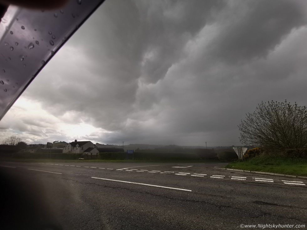
Either way I was fully committed to the chase, this would be our dog Ella's first warm season chase of Spring and I was hoping she would experience her first ever thunder, if she wasn't afraid then I could get her adjusted to future chasing a lot faster. Morning rain cleared through, radar showed messy shower clusters in the ROI moving N and sat imagery showed clear spells in the SW so it looked promising. If models were correct then storms could fire early so I wanted to be on the road getting eyes on the skies. I packed supplies then Ella and I hit the road, after a few breaks and dog walks we continued W and by late morning I pulled over in a layby five miles from Omagh.
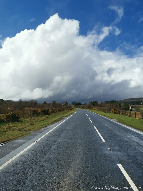 |
I seen blue skies so I drove in that direction and it was within those blue skies that convection was present thanks to growing solar insolation, this wasn't rocket science, find the clear skies then observe the cumulus in that area. There was a line of convection crossing the skies for miles in front of me all the way across the northern Sperrins. This was the largest tower, it got my attention as it was really trying however it didn't look like the caliber of what we want to see this time of year. The tower wasn't quite tall enough and it still didn't look that cold, however it was beefy and the base was very low, always a good thing. So I stood there in the lovely sunshine watching then decided to continue further W to get a better look.
 |
A few miles up the road I was at the turn off to lake Macrory just E of Omagh much closer to the base. The base itself was well sheared from any precip and it was low and had that good warm look to it, this is a super wide phone shot, base moving L to R. Breaks overhead revealed numerous white updraughts. I didn't know if I should stay here, go back E (which looked more cloudy at this time) or head W, when I don't know what to do I just stay put until instincts or a visual clue tells me different. Away to the SW behind this cell (tops were still struggling) I could see sunny breaks so that was encouraging, then soon a big line of towers and wispy anvils came into view, they where miles away to the S yet I could tell this was the first storm attempt of the day (sorry no images), they even had that thundery blue look to the base and precip curtains. I got a text from Colleen Webb saying there was a storm below the border moving N towards me with recent lightning, this was the very one I was watching. So I held my position, made some tea and had a snack and waited, that cluster was getting bigger and moving fast, I didn't see any lightning and I resisted the temptation to get the drone in the air to get images.
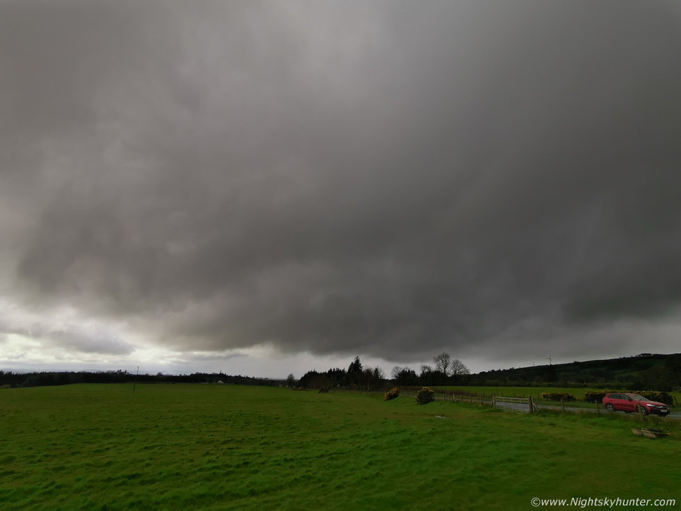
I got a call from Nigel McFarland who was watching developments from the north coast. He addressed the situation of that cluster on radar, it hadn't produced any recent lightning in a while which didn't sound good, however the cores went from weak to strong to weak then strong again at random positions along the lead sector, this was classic cell outflow triggering growth for an adjacent cell, this is characteristic of weaker shear. I chased E of the cluster anyway to stay head of it incase any structure formed, there was a road crew half way out the Omagh road this day with a temporary stop sign, I kept running into them as I shifted E-W over and over, I'm sure they were wondering what I was up to. I pulled in at An Creagan and got the drone in the air, the cluster was unimpressive however there was an attempt at shelf cloud formation however a shower formed in front and blocked the view and soaked the drone so I landed, then I drove further E to escape the shower and get ahead of the cluster which was fairly easy I might add. Finally I pulled in at Kildress and watched it approach, drone back in air, structure not good, a dark sky with precip advancing and long low cloud structures, another attempt at a shelf however it was a little pathetic, so much so I deleted all the images I took. It was 14.00 and good things should have been happening by now so I was starting to loose faith, based on what I was seeing I was doubtful of getting any photo opportunities at all, or even a storm for that matter.
The massive cluster overtook me with weak whale's mouth and heavy rain (no hail), Ella was afraid of the sound of the rain on the van roof, for some reason precip seems to rattle her. The outflow wind was quite strong then it passed and I was under moderate rain and grey skies. At this point I really didn't know what to do anymore, nothing was inspiring me at all. It turned out the southern section of the cluster produced lightning over the Lough Neagh/Ballyronan area, that section did look darker visually but there was still no dramatic clouds there to interest me. Stuck between going E or W I just drove to Beaghmore Stone Circles and waited under the rain on the verge of giving up. Nigel rang again, he was feeling the same way, there was lightning over the north coast from Coleraine all the way out to sea however he never seen anything and based on the sky he was giving up on his plans to drive NE as there was little justification in it, I felt the same. Nigel and I both agreed the structure was no good, the towers were not up to our standards, in fact, many of the updraughts were quite small and didn't look all that crisp or had that cold look on top. We both did agree we would not be giving up and I joked about five o clock magic.
The rain eased and I saw blue skies behind me, thank goodness, then I saw towers and a big anvil in the distance which were half decent looking, based on my visual impression of the sky that was my next target. Colleen Webb rang, she had just got out from work and was chasing and confirmed on radar that anvil was below the border, I said I might meet her later, for some reason the lough was calling. I drove back W once more, I passed the road crew yet again and got under blue skies with sunshine, that anvil was to my SW and gaining ground rapidly, I kept chasing it and ended up back at my original spot outside Omagh just N of Lough Macrory. The cell/s came in fast and soon they had formed a gust front and for the first time all day I finally had some structure to shoot.
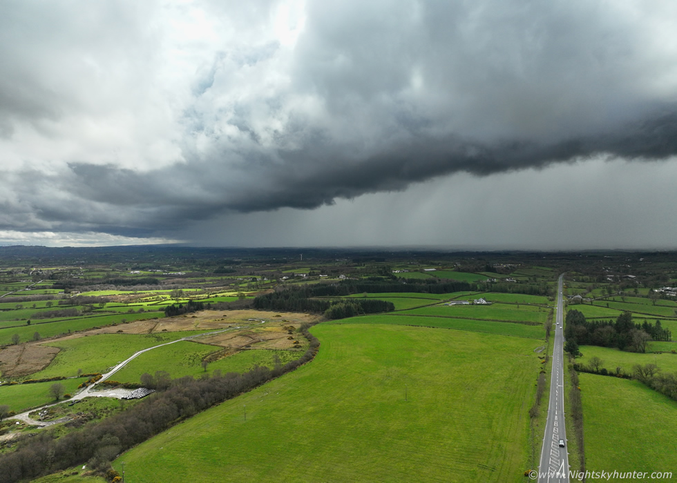 |
Drone in the air, facing W towards Omagh, this was the cell that had been below the border which was now in N. Ireland, yet it again it took on the mode of a weak multicell cluster with well defined core of precip, no sferics at this point but those could happen at any moment. I have to say I was starting to enjoy myself now, the sun would break out from cloud cover lighting the fields up in sunny sectors which really enhanced the contrast of the scene, big guster over the main road.
 |
I was shooting stills and video, if I could get a bolt over this road somewhere it would be the scene of the day, I never did see any lightning but at least I had storm clouds, I figured this was likely the catch of the day for me. Then as the cell neared the wind became very strong affecting the drone, I landed just in time and headed back E along the Omagh road once again to try and get ahead of it, I met that road crew, it felt like Groundhog Day, then I shot E at 60mph, got ahead and pulled in at Kildress once again.
 |
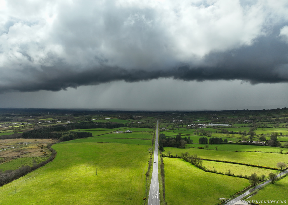
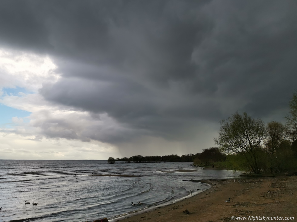
Whale's mouth and heavy rain buffeted the van, as the cell moved NE it grew stronger and formed a well defined line, it may even have developed an even better shelf on it however I never seen any images from anyone. Now it was 15.00 and I needed to make a very important decision, the AROME showed more cells in the Omagh area into late afternoon, however none of them were sparking so far so I expected this trend would continue. I also suspected all the rain in this area had cooled the atmosphere and may have affected the CAPE, furthermore cloud cover had shut off solar heating. My thoughts quickly turned to the E. Models showed good CAPE in that area into the late afternoon and early evening and there was far more sunshine there compared with the W, in such a situation I nearly always go where the sun is shinning, this has worked for me many times before in the past. I decided on some instinct to head to Ballyronan Marina at Lough Neagh. I wanted to get through Cookstown soon before the traffic got crazy and I was trapped in ques. Cookstown has got very bad recently in this regard so that was the last thing I needed, it was time to go.
As soon as I arrived on the outskirts of Cookstown I was stuck in slow traffic, it wasn't even rush hour, it seems that anytime between 15.00 and after 18.00 can be bad for slow traffic here depending on the day, it was likely the schools out causing the issue. After half an hour I got through the town and entered the faster freedom of the carriageway on my way E. A few miles from Ballyronan I pulled over to check the sky, there were several cells approaching the area, one had a big core and the other was more of a line and the two areas of interest looked to be merging together, I drove on and pulled in at Ballyronan over looking Lough Neagh. Already the vibes were much better than anywhere else I had been today, the sun was shinning, blue skies, it was warm, across the lough over the Antrim side was a nice sunlit cell which I watched for funnels. Then I met local photographer John O'Neill and then Colleen Webb arrived, it seemed everyone was targeting the lough this afternoon.
 |
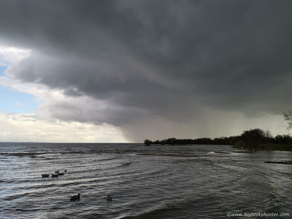
This was the view looking S as the lead cores on that cluster approached fast, the sky was turning dark, out of frame to my right was the underside of a gust front with churning clouds.
 |
Then a sudden flash of lightning lit up the clouds and precip core interface, it was a long intra-cloud bolt, then a few seconds later a loud rumble of thunder!, I couldn't believe it, hours of being on the road today in a high risk area for lightning and I got nothing then within minutes of arriving here a thunderstorm!, sometimes you have to trust your instincts, now I was delighted I had come here, it was 16.00 and one hour shy of five o'clock magic. This was the first thunder I had heard since September 2025 seven months ago and it felt great. I looked down at Ella to see how she was reacting, she was just looking around her wondering what the noise was but didn't appear unsettled at all, that was a good to see, that was Ella's first ever thunder in her ten months of life and hopefully the first of many more to come.
I stood outside watching the core waiting for more, we later learned this had actually produced a cluster of lightning strikes from E of Cookstown to Lough Neagh and I never heard the thunder earlier as I had been driving. Then the rain arrived and we all ran back to the cars for cover to wait it out. The core was fairly strong with intense rainfall and the outflow winds blew the rain in horizontal sheets across the car park, however it didn't last long as the fast flow had moved the cell over the water and behind it a clearance began to appear with sunshine and blue skies, we all grabbed the cameras and got back out to watch.
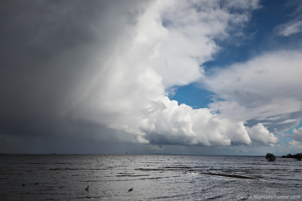 |
Suddenly we had structure, the rear or flanking area of the cell appeared in view over the lough lit bright white by sunshine while the dark core to the left was still in shadow, the contrast between the light and shadow was cool to see. I had been filming a vlog all day and really should have vlogged this part but I wanted to get images before it was too late.
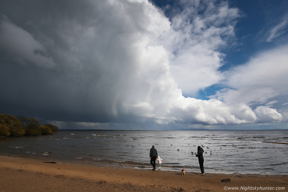 |
15mm wide angle on full frame covering a massive area of sky, sunlit flanking updraught with a line of cumulus taking up the rear with hail dripping in strands from the side with blue sky, then a family with their dog and kid walked into the scene making for interesting foreground subjects to provide a sense of scale. For me this was the photogenic catch of the day, I was delighted to have got storm structure after such a long day of chasing, even at this image scale the top section of the updraught is out of frame aloft.
 |
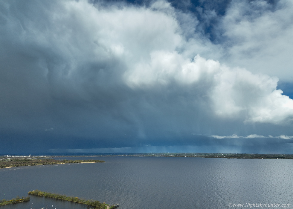
The entire scene was too large for the drone so I had to wait for the storm to move further away then got the drone in the air for a few images. John and Colleen were shooting away and the sun shone bright and warm.
 |
Water lapped at the shore and the ducks quacked, it was a serene moment as the now quiet storm crept away to the Antrim side of the lough
 |
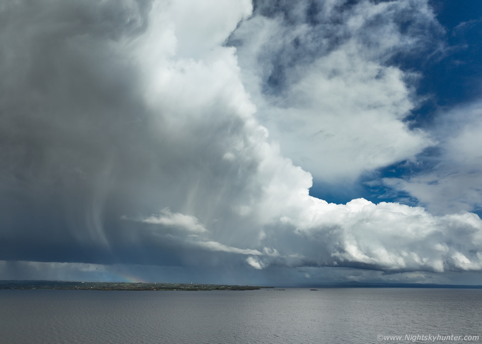
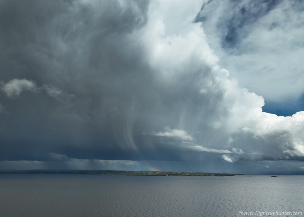
This was only 50% of the storm, the other section was to the left with an anvil sporting mammatus, you can see this part on the vlog. The clouds and precip core had that classic thundery blue look. We were all delighted to get a storm so we hung around for another two hours in case there was anything else, another cell and line passed with heavy rain later however there was no structure so this really was the scene of the day. I can tell you it was great to break in the new chase season in with this storm, it's especially nice to get something so early, perhaps a good omen of bigger things to come!
The next day, April 18th, was barely worth mentioning, low CAPE but moderate shear, it was late evening and one hour until sunset when Roisin spotted a rainbow outside. I watched it for a while, it was average but not worth getting the drone up for, then it began to intensify so I sent the drone up for a look not really expecting anything interesting.
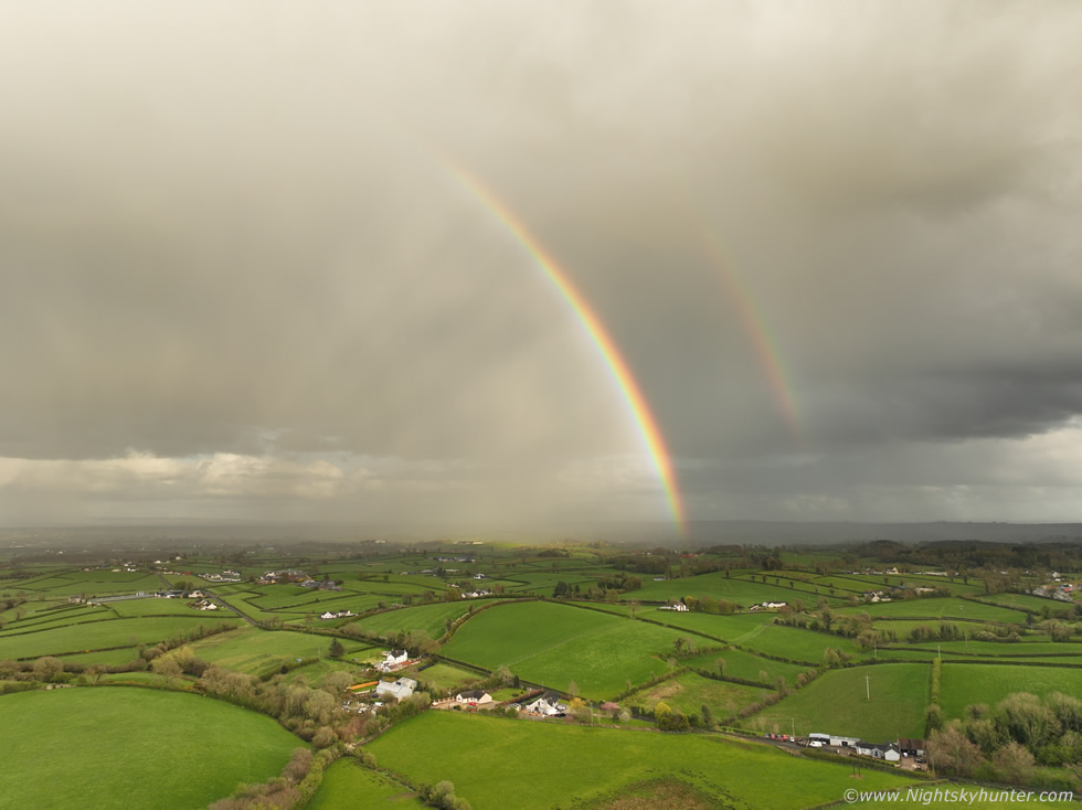 |
The bows were only partial and formed on a small shower however I could make out shafts of anti-crepuscular rays so things became more interesting
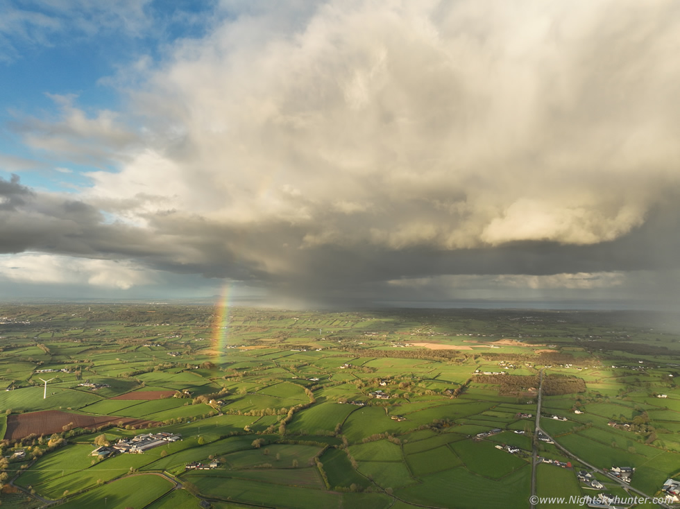 |
The bow shrunk however it was the shower itself which began to steal the show, it developed chunky structure along the base, even fairly solid at times and the contrasting warm light with the fields and bow and blue sky made for a really pleasant moment which I really enjoyed.
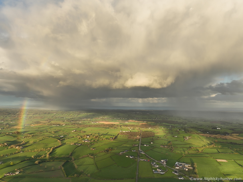 |
Another shower core formed at the rear, overall just nice structure and an unexpected end to the day worthy of checking out, I will take it, especially hot on the heels of yesterday's storms.
Full vlog of the April 15th chase day with phone and drone footage. I hope you enjoyed the images and report, the Spring season is starting to develop and despite high pressure now showing on the models I'm quietly optimistic of a few good storm events to come this season. Thanks very much for reading.
Martin McKenna